The forecasts were pretty much the same as usual: "May", "Possible", "Could".
If you actually paid attention to the radars and models and what the weather people rushed through, the snow was actually only ever predicted to stay North of Atlanta, and south of that would get mostly rain.

Of course, because of what happened two weeks ago - not to mention the urgency of the news reporters and the Governor and other Officials - people freaked out, afraid it would be worse than they were saying.
We did, too. R decided to re-schedule his riding an ambulance as part of his Clinicals for EMT school today, and J got off at the fire dept this morning but decided not to even come home, and instead spent the entire day hanging out at the ambulance station even though his shift didn't start until 8:30 pm tonight.
Here, we just got some sleet early. The driveway and roads were just wet, not slickery.

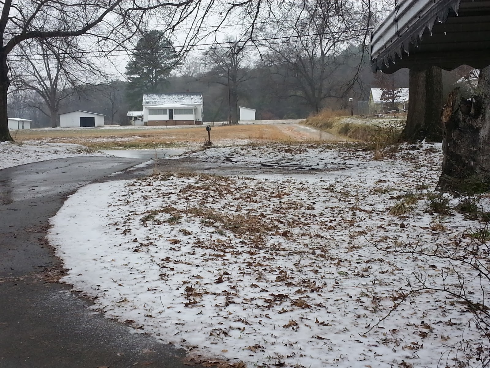

Looks like snow, but is actually tiny ice pellets, and this is usually the kind of "snow" we typically get the few times we actually get any at all. Two weeks ago snow was much different from this.

Out temps stayed up near 40* all day, so most of this melted away. This is a typical "winter storm" for our area, and the reason we don't usually get too het up over "possible" sleet/snow/wintry mix predictions.
Tonight we're waiting to see what tomorrow will bring. According to the news, we're in for a "catastrophic","once in a life time", "historical" ice storm.
Or, well, since the 1973 ice storm, I guess, haha.
The forecasts have been all over the page all day. Earliest predictions were Extreme Ice across Georgia, with large amounts of snow to the north.


I've been watching the local news for about the past two hours and even in that time what they've been saying has changed.
At one point Ken Cook, meteorologist, said "don't expect to wake up and see armageddon". Things will develop slowly. Freezing temps are supposed to be wrapping around and coming in from the northeast, and will go underneath the moisture moving in from the west. About 3am the temps will reach freezing and the rain will fall through the freezing temperatures and freeze on contact as it hits roads and trees and powerlines though out the day tomorrow.
Then he went away and the other meteorologist came on and was showing a radar showing "freezing rain now falling in the Atlanta area".
Ken Cook came back on later and plain out told us the radar was "enhanced", that is, colored in by man or a person, and since the temps were still above freezing, he doubted they were actually seeing any freezing rain.
Later he was on there showing some other radars of what they think it'll do over the next few hours, and it shows some wintry mix, rain, snow, and moving out by about 4am.
I understand weather is really difficult to forecast, with so many elements and the way it comes together - or falls apart - or changes...but sometimes, several times in the past, it's seemed to me that some of them try to tell one thing - what turns out to be the truth - but the others tell it different.
They hype it up and upset people, and make us doubt them crying wolf, and then we end up caught off guard.
Oh well. I guess we'll see in the morning what we get. If I'm not around for a few days, they might have gotten it right.

No comments:
Post a Comment